Google Rolls Out AR Navigation In Maps App For Local Guides
During last year’s Google I/O, the company showed off the integration between Google Lens and Google Maps. It looks like the feature is nearly ready to be rolled out to the masses, as reports indicate a handful of users already have access to it.
To recap, Google Lens works by having the company’s machine learning algorithm see the world through a phone’s camera in real time. Integrating this with Google Maps allow for augmented reality (AR) additions like floating arrows pointing you to the direction you need to head to.
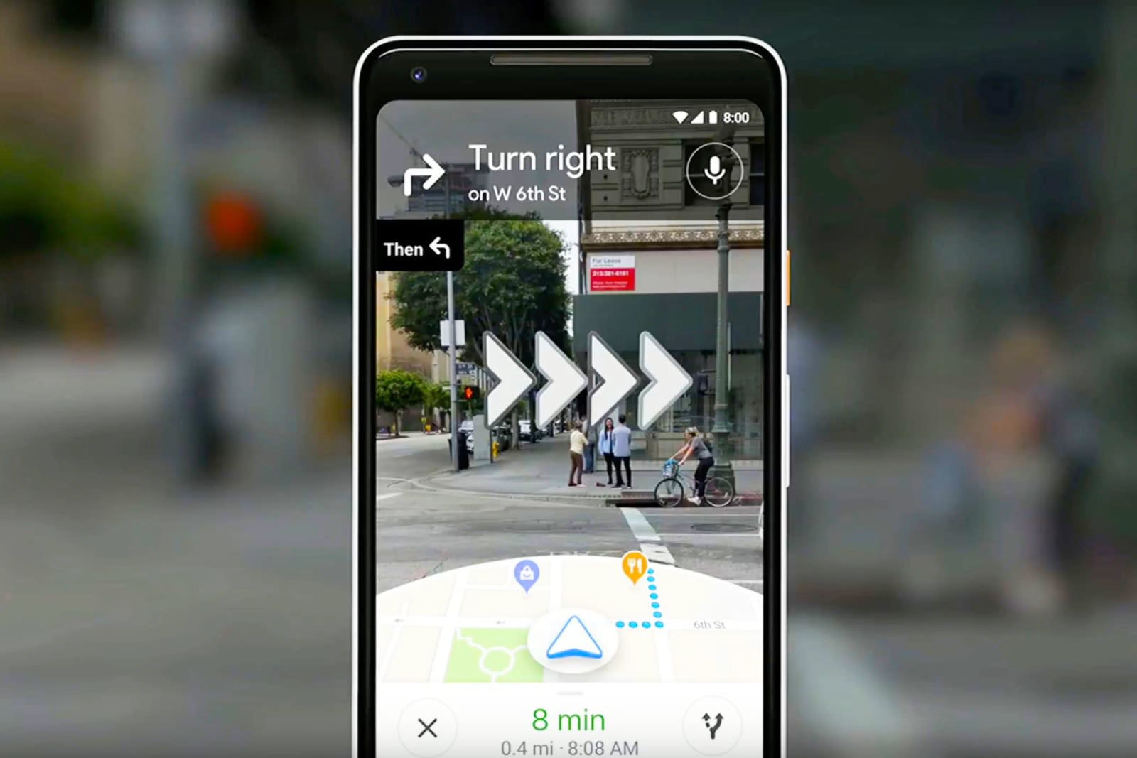
That said, it looks like it won’t be taking over as the standard method of using Google Maps. You can’t use the AR view consistently; the app will ask you to put the phone down after awhile. In all honesty, Google could have capitalised on this with the Google Glass, had it not been relegated to industrial use.
For now, it looks like only Local Guides, or community reviewers, have access to the feature. Google says that it still needs more testing before it can be rolled out to everyone else.
(Source: Wall Street Journal via Engadget)
The post Google Rolls Out AR Navigation In Maps App For Local Guides appeared first on Lowyat.NET.
from Lowyat.NET http://bit.ly/2BucysZ
Labels: Lowyat

0 Comments:
Post a Comment
Subscribe to Post Comments [Atom]
<< Home